| Summary: | The Archaeological Atlas of the 2 Seas project aims to map the available underwater data for the two seas. The first step will merge French, British and Flemish data to create a comprehensive underwater archaeological landscape, which will include the location of known shipwrecks, contextual data and legal and regulatory information. Thanks to this, the project team will be able to determine zones of major interest where they will organize archaeological surveys alternating between the coasts of each partner. An international team will ensure that the new expertise is shared between partners. The information will be organised into a database linked to a GIS system, which will be constructed during the project and put online. This will be accessible to the different partners involved, and also to heritage managers (marine aggregate extraction, windfarms, managing wrecks with hazardous cargoes…) as well as to researchers, students and the public at large. |
| Timeframe: | 30.10.2007 - 30.06.2012 |
| Total project budget: | € 2 774 462 |
| Total amount of ERDF requested: | € 1 386 954 |
| Grant rate: | 49 % |
| Status: | Closed |
| Web address: | No link available at the moment |
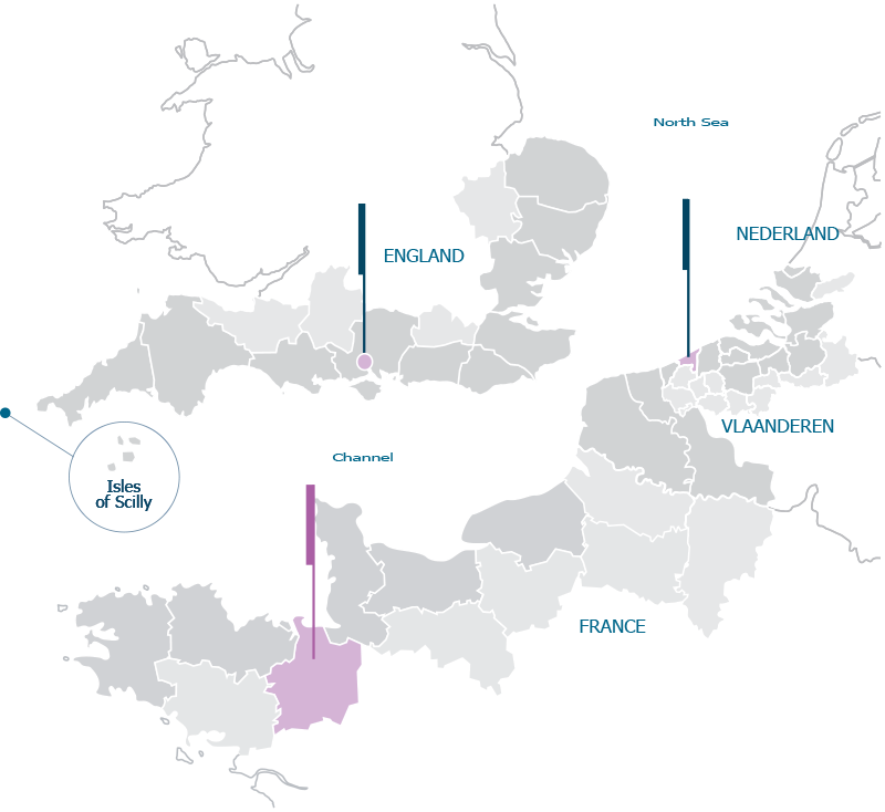
Sharing both the English Channel and the southern North Sea, these three coastal states have a common heritage drawn from a shared maritime history. Europe's foundations rest on wars, trade and alliances, while shipwrecks bear testimony to our often-shaky allegiances, underwater archaeological landscapes illustrate our history dating back many thousands of years. The overall aim of the A2S project has been to map underwater archaeological sites in the shared seas of France, England and Belgium and to give access to this data through an interactive GIS interface. Its aim is to combine the knowledge and information related to the underwater archaeology in our shared seas so that each country has access to all possible information, not just that from its own national resources.
The objectives are to:
- build an international archaeological team
- share knowledge and data about underwater archaeological sites
- create a publicly accessible Geoportal about the underwater cultural heritage of the 2 seas area
- survey underwater archaeological sites to enhance understanding of our submerged
cultural heritage
- promote our common underwater cultural heritage through education and outreach
- share experience and best practice in archaeological techniques
- assist students and volunteers in gaining practical experience of underwater archaeological methods
Activity 1 involved desk based research within the A2S project to build up a database on common submerged cultural heritage, gather more data about known shipwrecks, locate new sites and learn about unidentified wrecks. Data was brought together through desk-based study of existing documentation. Sources of documentation consulted include National archives and inventories, Hydrographic Office records, plus primary and secondary material. Hundreds of sites have been researched and the various documentary sources consulted during the desk-based study providing new historical insights.
In Activity 2 the A2S Geoportal developed a comprehensive vision of the marine archaeological landscape by providing unique access to Belgian, English and French data, bringing together the submerged archaeological heritage that we share. The 3 partners have developed their own databases in relation to their needs and objectives. The A2S Geoportal connected and synchronised with those databases in order to retrieve a selection of data about the underwater cultural heritage of the 2 Seas. - The three partners of the A2S project have developed their own databases that will connect and synchronise with A2S Geoportal. A combination of historical and archaeological data has been gathered and made publicly available through the Geoportal.
One of the main activities of the A2S project was carried out in activity three and involved the field study and survey of archaeological sites under water to enhance understanding of our submerged cultural heritage. New and existing geophysical and archaeological techniques have been combined and tested on sites on the beach or underwater for possible application in archaeology.
Research and data gathering
- 1660 archaeological sites, covering the English Channel and Southern North Sea are listed in the A2S Geoportal (www.a2s-geoportal.eu)
- over 3,000 underwater sites, artefacts, and historical photographs enhance the dataset
- High resolution background bathymetry and high resolution ancient charts and aerial photographs are online to contextualise the archaeological sites. Scientific data has been published in a report that has been sent to the national archaeological authorities
New knowledge and approaches
- 100 sites have been investigated by the partners and 36 geophysical anomalies were dived and inspected. The archaeological sites, investigated range from Prehistoric submerge landscapes like the Biéroc-la-Mondrée and Bouldnor Cliff sites, to Second World War shipwrecks like HMS Wakeful.
The Education & Outreach aspect has a number of results
- Maritime Bus mainland European road trip
- live video
- Exhibition and A2S 3-nation Schools Programme
- The A2S 3-nation Schools Programme has enabled the Belgian partners to develop a new relationship with teachers and pupils of a local school.
- French and English partners have been able to develop existing school partnerships by offering a programme of activity and resources that did not previously exist.
- 62 pupils and 9 teachers in 3 countries have been introduced to maritime archaeology and have an understanding of how it relates to traditional school subjects and their national curricula.
The partners of the A2S project have been highly involved in all aspects of the project. Each partner was in charge of the implementation of the actions in its country. During the Desk-based research the partners worked together to gather information on archaeological sites of common interest or because the data was kept in a partner’s country. Each project partner made its own selection of sites to be investigated during the project based on research priorities and with reference to national programmes.
The range of beneficiaries of the project is extensive and varied, including scientists, archaeology enthusiasts, the general public, schools and funders. Recognising the challenges and opportunities presented when trying to target such diverse audiences, the A2S project has developed a broad range of methods and approaches incorporating a variety of media. Approaches range from rom a short, amusing animation to a 35-minute documentary not to mention the freely accessible online Geoportal. This all means people with differing levels of involvement, interest and understanding can learn about, and access information from the A2S project.The activities have fostered the international research collaboration between the 3 countries. The A2S Geoportal gives a unique gateway to promote the research of the archaeologists of the Channel and the North Sea. In each partner’s organisation and countrythe A2S project has enhanced the capacity to achieve archaeological research on the field.
The A2S project had an effect on each territory. Generally it has strengthened the scientific base and network between archaeologists from England, Belgium, France and the Netherlands through the research activities implemented. The impact has been direct on the number of archaeological sites that are know better known and better disseminated amongst the public. The A2S project has also worked closely with schools in order to promote in the 3 countries the importance of our underwater cultural heritage and more broadly of our common History. As the project has drawn to a close, the international team has made a wealth of information available for access via the Geoportal. This can now be used for a broad range of research topics. These could range from the study of ancient trade routes and comparative studies on naval architecture, to the evolution of nautical weaponry and even the study of the possessions that characterised the daily lives of mariners.
The real added-value of a cross-border collaboration to the A2S project is that this project could not have been possible without a cross-border collaboration. The heart of the project is to bring together the partners in the implementation of the different activities. The Desk-based research (Act.1) would not have this wealth of new data without the work of the 3 partners. The A2S Geoportal (Act.2) would have been a national database without the input of the 3 countries that now have a common gateway to present our underwater cultural heritage. The Fieldwork operations (Act.3) have created an international team of archaeologist who now can work together and have shared experiences. The 3-nation school programme was possible because of the collaboration and successful because the partners had learnt to work as a team. So, the entire A2S project is based on a successful cross-border collaboration, and all the initiatives have benefitted from it. A2S combines the knowledge and information related to the underwater archaeology in our shared seas so that each country has access to all possible information, not just that from its own national resources.The benefits for each territory is desk-based research and in situ investigation of known and unknown archaeological sites that feed into the national archaeological research and national databases. As a result of the collaboration, larger undertakings were attained and all partners have emerged stronger; being more able to deal with a broader cross section of maritime archaeological challenges.
The partners will continue to actively work together after the A2S project. The partners are already involved in other European initiatives. The Arch-Manche lead by the HWTMA does not have ADRAMAR and HF as partners, but it is planned that they will contribute to that project through the French and Belgian partners. Also, the SPLASH-COST project includes the 3 partners of the A2S, so we will continue to collaborate under this new framework. The partners are considering developing a new project centred on education and dissemination of underwater archaeology through the curriculum. We cannot presume for the future, but the partners have built a network that will last.
For cross border projects it is important to:
- Set up the aims and objectives of the project with all the partners of the project or at least to be sure that they all agree with them.
- Have realistic aims and objectives reflecting the capabilities of the partnership.
- Have excellent communication between the partners
- Follow up on the achievements on a regular basis to keep the pace in the reaching of objectives.
- Use the major modification tool in order to make the project evolve during its implementation.
- Record all the changes needed during a period and then ask for a major change that reflects the state of the project.
- Remember it is normal to experience difficulties in the application of the schedule and the activities planned.
- Have good communication with simple tools accessible to all the partners
- Ensure that all the partners agree on the implementation and the activities as well as the evolution of them during the project lifetime.
- respect the differences between countries
- Have a flexibility in the project structure in order to address the unexpected evolution of some aspects of the project.
- Have an open mind within the partnership, to accept criticism and reorientation of the idea that the partners have elaborated together.
- have a common strategy
- have a strong and realistic communication strategy that should be followed during the entire project.
All the results of the project have been published or will be, in scientific journals. The dissemination of the results through the A2S Geoportal ensures that they will be available after the funding of the A2S project. This has been planned through a long term hosting contract with Geodata that ensure the presence of the A2S Geoportal until December 2015, including maintenance of the tool. All the scientific data has been published in a report that has been sent to the national archaeological authorities in order to ensure that the results will not be lost after the project. The paper publication, the A2S documentary and the educational toolbox will be available on the A2S website and the partners website for future initiatives. All the documentation has the INTERREG logo and the sponsors’ logo that ensure their visibility after the end of the project. The dissemination of information collected through the A2S project and making data available to all audiences, has been a core component of the A2S project. The range of audiences the project aimed to reach was extensive and varied, including scientists, archaeology enthusiasts, the general public, schools and funders. Recognising challenges and opportunities presented when trying to target such diverse audiences, the A2S project has developed a broad range of methods and approaches incorporating a variety of media.
The A2S project should be seen as a pilot that has pioneered a range of successful initiatives. It has unified international teams of archaeologists, volunteers and school children ranging in age from 8 to 88. It has provided a platform for cross-border collaboration in a way that is seldom witnessed. This is something worth maintaining as foundations have been laid that can enable key elements of the A2S project to be rolled out to a wider audience. First, the Geoportal provides a vehicle for a wide section of the diving and non-diving community to contribute, thereby increasing the number of submerged heritage sites. Secondly, the international team of maritime archaeologists now have the skills and capacity to deliver projects on a supranational scale. Thirdly, research between nations by vocational volunteers has built bridges and shown how it can link cultures. Finally, the submerged cultural heritage has proven to be a very powerful educational tool with great teaching benefits. A new approach to understanding our shared maritime history is now under way using the combined skills of French, English and Belgian archaeologists.
More sites should now be integrated into educational resources that can enthuse school children to engage with their national curriculum in a fun and proactive manor. Beyond the visible partnership of the A2S, the project has brought together a lot institutions that will continue to work together, for example the university of Gent will work with ADRAMAR on a geophysical project, the CNRS is involved in the Arch-Manche project and so on. The ERDF funding is a real added value to a project and it is not always easy to start a new project just at the end of another, however we are confident that the network will be working for many years.The partners will continue to use the results of the project and the A2S Geoportal will also be fed by new data of the partners. The educational toolbox will be promoted in schools in England, France and Belgium in 2013. So the work done by the partners will continue to be very useful and will be the core of new national initiatives.


